Skip to content
Home
About us
offer
Capturing the real world
Military geodesy
Surveying
Military geodesy
What we’ve achieved
Blog
Map for planning purposes – MfPP
Laser scanning
Building permit
Orthophotomap – the product of a surveyor’s work
Notification of construction – with surveyor’s assistance
LAND LEVELING – the key to efficient project implementation
MAP – a basic tool in hands of surveyor
Railway surveying
How surveying supports archaeology – our project in Sulmierzyce
Contact
Facebook
Youtube
Linkedin
Home
About us
offer
Capturing the real world
Military geodesy
Surveying
Military geodesy
What we’ve achieved
Blog
Map for planning purposes – MfPP
Laser scanning
Building permit
Orthophotomap – the product of a surveyor’s work
Notification of construction – with surveyor’s assistance
LAND LEVELING – the key to efficient project implementation
MAP – a basic tool in hands of surveyor
Railway surveying
How surveying supports archaeology – our project in Sulmierzyce
Contact
What we've achieved
Gallery of finished projects
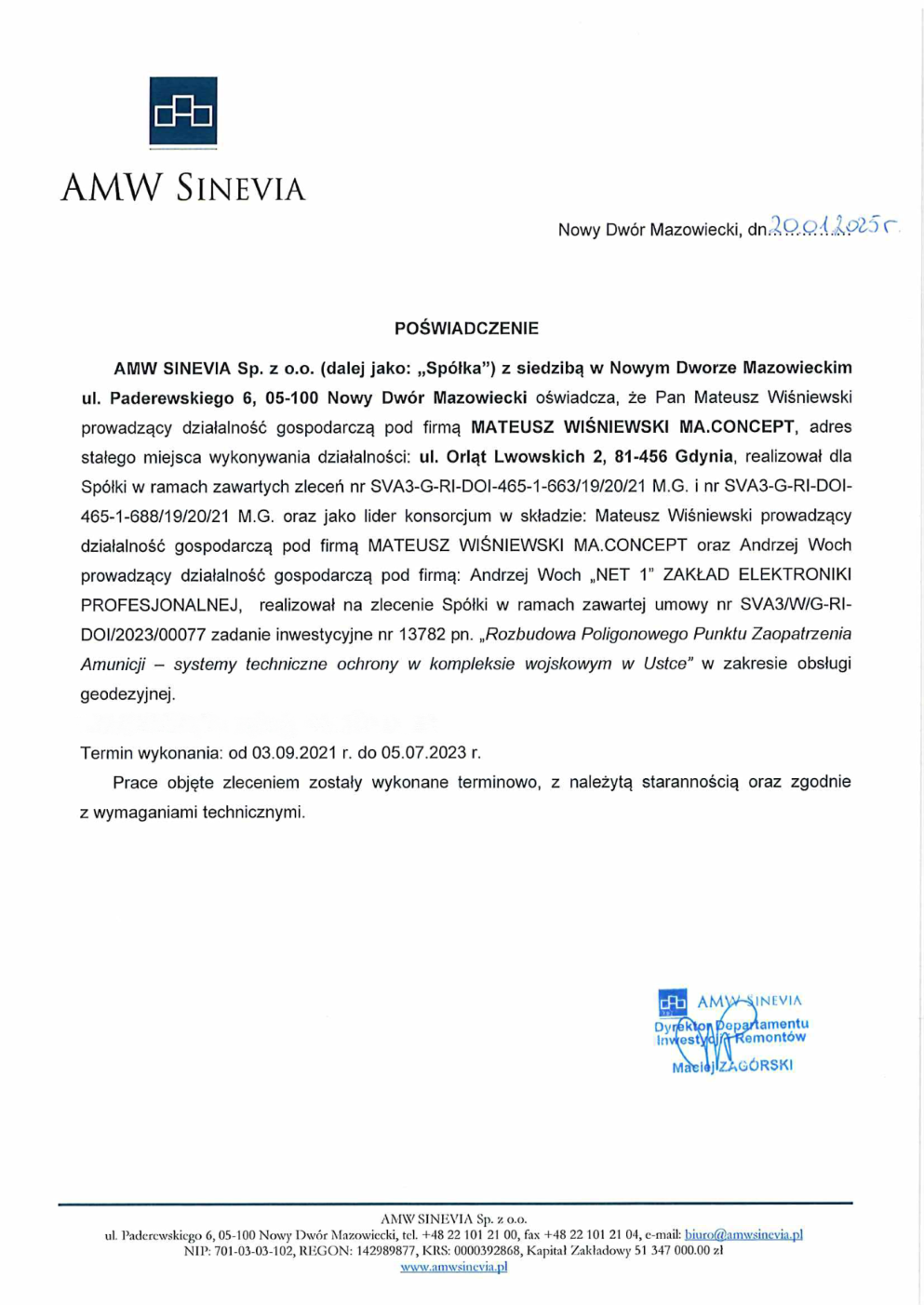
References
