Skip to content
Home
About us
offer
Capturing the real world
Military geodesy
Surveying
Military geodesy
What we’ve achieved
Blog
Map for planning purposes – MfPP
Laser scanning
Building permit
Orthophotomap – the product of a surveyor’s work
Notification of construction – with surveyor’s assistance
Post-construction inventory in surveyor’s hands
LAND LEVELING – the key to efficient project implementation
MAP – a basic tool in hands of surveyor
Contact
Facebook
Youtube
Linkedin
Home
About us
offer
Capturing the real world
Military geodesy
Surveying
Military geodesy
What we’ve achieved
Blog
Map for planning purposes – MfPP
Laser scanning
Building permit
Orthophotomap – the product of a surveyor’s work
Notification of construction – with surveyor’s assistance
Post-construction inventory in surveyor’s hands
LAND LEVELING – the key to efficient project implementation
MAP – a basic tool in hands of surveyor
Contact
What we've achieved
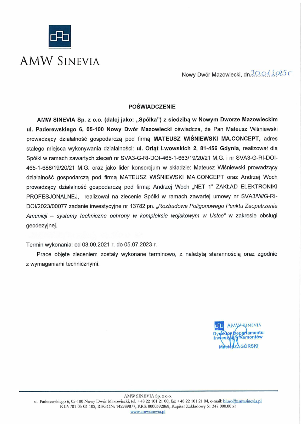
Gallery of finished projects
References
